Two kinds of ground
West Gippsland's housing sits on two very different kinds of ground, often within the same town, and a stump that suits one is wrong for the other.
The red hills. The rolling country around Warragul, Neerim and Thorpdale is red ferrosol, which Victorian Resources Online describes as very deep volcanic soil, probably some of the oldest in the state, with clay loam surfaces grading into light clays, well drained and moderately to strongly acidic. The Department of Agriculture's West Gippsland soils guide calls them the red gradational soils of basalt origin known as krasnozems, deep, friable and well drained, with a pH around 5.2 to 5.5. Thorpdale, a former volcanic crater, is famous for the potatoes that grow in it. For a house, that means ground that digs easily, drains well, and quietly eats untreated timber and unprotected steel with its acidity.
The flats. North of the Princes Highway toward the Moe River, between Darnum, Trafalgar and Yarragon, the ground was the Moe Swamp until the 19 kilometre Moe Drain was dug in the late 1880s and the land turned to farmland. Trafalgar's heritage study records the township forming in 1895 as the Moe Swamp Settlement while the swamp was still flooding. VICSES's Moe River Flats guide says the flats experience flooding on a frequent basis. For a house, that is ground that stays wet, that can be reactive clay moving with the seasons, and that needs stumps and footings set deeper and wider than the hills do.
The rain on top of it
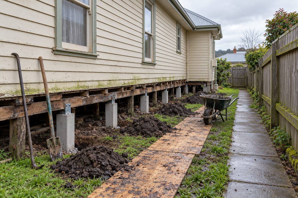
The Bureau of Meteorology's long record at the Ellinbank dairy research station, near Warragul, averages 1,100 mm a year over 132 rain days. The wettest months are September at 115 mm, July at 114 mm and August at 112 mm; the driest is February at 46 mm. July's mean maximum is 12 degrees and its mean minimum 4.5. The current station at Nilma North recorded 1,036 mm in 2020 against a long-term average of 1,005 mm, and 1,191 mm in 2012. The practical result is a subfloor that is cold and damp from May to October every year, which is the condition timber stumps rot in and the reason vents and drainage are part of every restump here.
What each kind of ground does to a house
| Ground | What happens | What the stumps need |
|---|---|---|
| Red ferrosol hills | Timber rots at the ground line in acid soil. Concrete stumps set shallow can sink a little into friable loam. | Concrete or galvanised steel on a pad, set to firm ground. Drainage along the uphill wall on a cut block. |
| Flats and old swamp | Wet for months. Where it is reactive clay it swells and shrinks with the seasons and cracks open in late summer. Stumps stand in water in a wet winter. | Deeper holes, wider pads, concrete or steel. Adjustable steel on the corners that move. Grading, vents, an ag drain, sometimes a membrane. |
| Shaped ground in new estates | Cut-and-fill lots. Slab edges drop where fill settles or a downpipe soaks the corner. | Not a stump question. Drainage first, then underpinning on an engineer's design. |
| Strzelecki foothills | Steep, high rainfall, landslip country. Houses on cut-and-fill platforms with downhill footings on fill. | Engineer's input on anything structural, drainage above the house, steel stumps on the downhill side where relevelling is likely. |
What nobody can tell you from the street
The site class of a block under AS 2870, the standard that sorts ground into classes from stable to highly reactive, is set by a geotechnical test, not by the suburb. A soil testing firm working in Warragul puts it plainly: the town has a wide range of land types and the soil is very different from suburb to suburb. No verified site classification has been published for any Warragul or Drouin estate, and this site does not quote one. Where a job depends on the class, which underpinning always does and deep restumping on the flats sometimes does, an engineer orders the test.
Landslip and the hills
The West Gippsland Regional Catchment Strategy says parts of the Strzeleckis are very prone to sheet, tunnel, gully and stream bank erosion and that landslips are common. In January 2021 the Gazette reported that October rain had triggered landslips along five roads including Sunny Creek Road at Trafalgar South, the Warragul-Leongatha Road at Seaview and the Yarragon-Leongatha Road at Allambee, and the June 2021 storm closed a 45 kilometre stretch of the Mount Baw Baw Tourist Road with slips. A house on a cut platform in that country has a different set of questions, covered on the hills page.
Flood and the flats
VICSES lists Warragul, Drouin, Drouin South, Trafalgar and Yarragon as the townships where most residential flooding in the shire occurs, and names Hazel Creek and Spring Creek as Warragul's main waterways, with floods in February 2011 and February 2019. Council's attempt to update the flood overlay maps for the whole shire was abandoned in 2022 because the new estates had changed the drainage, so the maps are not the last word. A house near a creek or on the flats is a house whose subfloor drainage matters more than its stump type, and whose future building work may need report and consent for flood-prone land. The overlays page covers it.
What soil knowledge cannot do
It cannot classify your block; a geotechnical test does that. It cannot predict a wet winter, which is what moves clay. It cannot tell you whether the stumps under a particular house have rotted, because that is an inspection. And it cannot change the ground, which is why the answer on the flats is deeper stumps and drainage rather than hoping.
Check the current rules before you rely on this
This page summarises published descriptions of the soils, climate and flood history of Baw Baw Shire as they affect house stumps and footings. It describes the rules in general terms as they stood in October 2026. Standards, forms, thresholds and fines change.
The authoritative sources are Victorian Resources Online on red ferrosols, Department of Agriculture, managing soils under intensive cropping in West Gippsland, Bureau of Meteorology climate statistics, Ellinbank Dairy Research Institute, VICSES Moe River Flats local flood guide, VICSES flood guide for Baw Baw Shire, West Gippsland Regional Catchment Strategy, Strzelecki local area and A1 Soil Testing on soil testing in Warragul. Where anything here differs from those sources, they are right and we are not.
We are not building surveyors, engineers, planners or lawyers. For what applies to your house, ask a registered building surveyor or ring Baw Baw Shire Council on 03 5624 2411.
Accurate at the time of writing, October 2026. Always check the source before relying on it.